How an Ex-Googler and Machine Learning Engineers Are Finding New Drone Applications
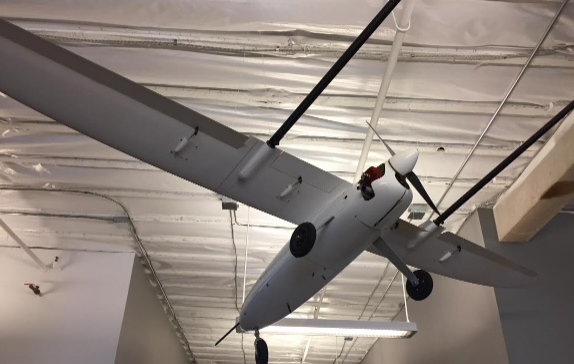
There is a large silver antique winged drone suspended from the ceiling of the DroneDeploy office in San Francisco. It doesn’t even look like it’s from this side of the millennium when compared to the quad-copter drones you have probably seen whirling around everywhere from your local park to professional sporting events.
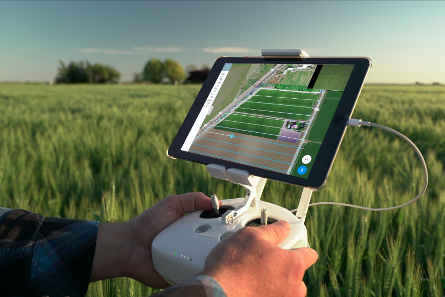
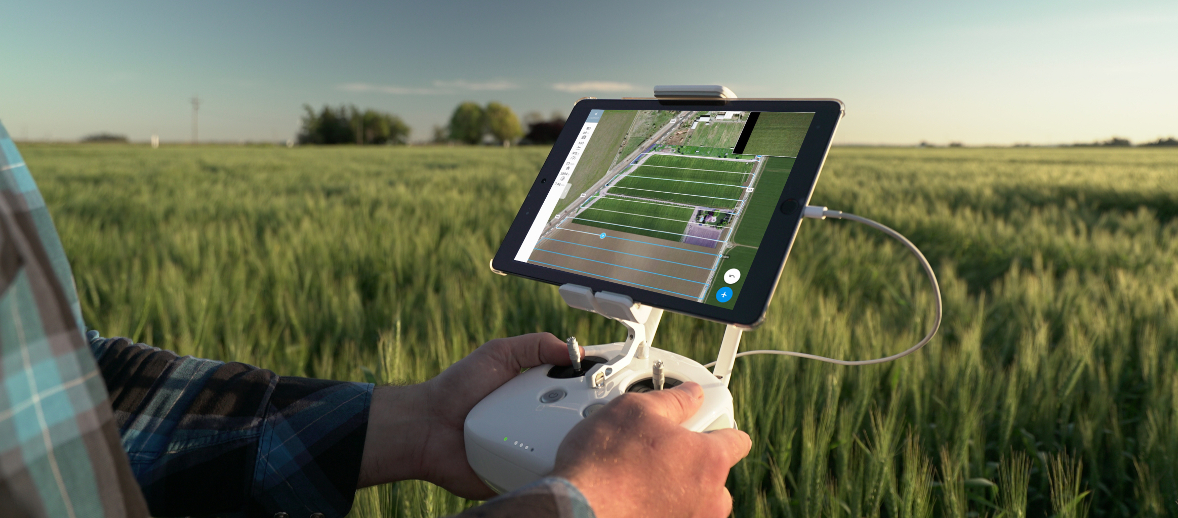
Despite the seemingly overnight ubiquity of drones, there’s probably one place you might not expect to see them: hovering above America’s farmlands. And yet, farmers today are using drones to do everything from check on the health of their crops to apply pesticides to conserve water. With smartphone apps that enable control from the push of button and at a cost that is far lower than hiring a specialized pilot, more and more farmers are turning to drones to be their “eye in the sky.”
In addition to DroneDeploy, companies like Precision Drone and AgEagle are part of a new breed of companies tackling this space, and over the last few years, they’ve revolutionized much of the way that farming is done.
Take the example of searching for health issues among crops. This has long been done by simply monitoring the fields on foot — a tedious task under even the best of conditions, but a massive headache when you’re talking about ten-foot tall cornfields that have to be navigated in the middle of a blazing hot summer. With drones, farmers can send unmanned vehicles out into the field to spot infection, plant seeds, and identify areas that need further irrigation.
DroneDeploy was founded by long-time friends and South African natives Nicholas Pilkington, Jono Millin, and Michael Winn. Pilkington and Millin earned their Ph.Ds in machine learning, at Cambridge University and the University of Edinburgh respectively. While living in the U.K. they reconnected with one another and with Winn, who had taken a job in Google’s Dublin office. One afternoon Winn showed up at a park with gifts for Millin and Pilkington: two radio-controlled helicopters. It wasn’t long before they began modifying the helicopters, adding small digital cameras to their front ends.
“We thought it was really cool, but there was no first-person view feed so you couldn’t see anything. We would set the camera to take a photo a second, fly around for a while and then sort through 800 pictures to find a good one after cropping it and readjusting it to make it look reasonable. Previously it was really expensive and complicated to do this. You needed to have hardware and training to be a pilot and here we were, a couple of guys flying these remote controlled helicopters and getting these professional-quality aerial photos,” Millin recalled.
The three friends studied applied math at Rhodes University in Grahamstown, South Africa, and continued to stay in touch after graduation before eventually reconnecting in the U.K. Over time, their modified RC helicopters and the aerial photography they were capturing started to get noticed. The helicopters gave way to drones with autopilot capabilities and the trio started to see business potential.
“We started to ask – ‘Why aren’t businesses using this?’ Industries like construction, mining, agriculture, forest conservation, and search and rescue could all benefit from this kind of imagery. There was this very cool piece of hardware, but what was missing was easy-to-use software that was reliable and predictable so somebody who doesn’t even know how to fly a drone can go out and make a 3D map.”
In addition to its applications within agriculture, DroneDeploy makes it easy for anyone to turn a drone with a camera into a mapping tool, creating 3D maps that are made of thousands of images stitched together.
“That was kind of the key thing we decided to build the company around. We wanted to make it easy for anyone not just to operate a drone, but actually to get data out of them that would help drive business decisions,” Pilkington said.
Out of their tiny shared apartment, he began coding and working on prototypes, while Millin soldered drones together from various parts (this was before they were widely available on the Internet) and Winn hit the phones to sell. Eventually they would take their drone out for test flights, though things were far from smooth sailing at the outset.
“Probably one in five crashed. We’d go out and test this thing and it would crash and we wouldn’t know if it was something we did or a mechanical failure. So that was really hard trying to identify what went wrong initially,” Millin remembered.
Despite early setbacks, they were able to apply their knowledge of machine learning, cloud computing and data management to take what was being captured and make it applicable to a variety of business challenges.
“We realized we were relatively well-positioned to solve many of the problems we were seeing using software. While people were trying to make things fly we were thinking ‘Where is this going to be in the next couple of years?’ We were going to need a way to control the drones easily, making sure they captured the right stuff and that they understood the data they were collected,” Pilkington explained.
DroneDeploy eventually launched in 2013 and the three moved to San Francisco to join the incubator AngelPad. Four years in, the cloud-based platform they developed is used in 150 countries around the world.
In the future, Millin envisions drones that are fully automated field scouts that need no human interaction at all. He predicts they will be charged through solar panels and complete set tasks on a schedule, sending notifications to their owners as they gather data.
Pilkington sees exciting times on the horizon for DroneDeploy as more drones take to the sky. He hopes to continue advancing their software so that it’s as simple to use as turning on a blender.
“I think that the proliferation of drones has been really exciting to see on the hardware side and we want to match that accessibility on the software side. We want to help people use drones to do valuable things regardless of what industry they’re in.”